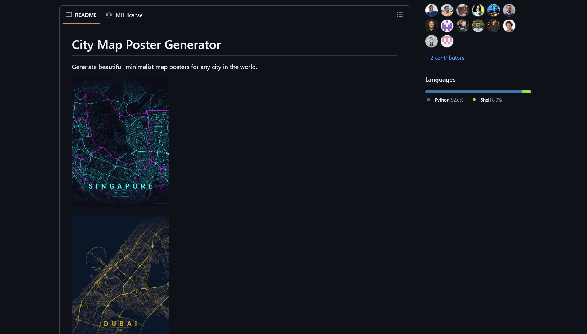
MapToPoster is a lightweight generator that renders minimalist city maps from any location you type, adds stylized text and coordinates, and exports high-resolution files ready for printing. The project is open source and aimed at designers and individuals who want custom map posters without paying for pre-made prints.
MapToPoster (repo by originalankur) is a small tool that converts geographic data into printable, minimalist city map art. You provide a place name, the tool renders the street grid and basic landmarks, lets you customize colors and layout, and produces a downloadable high-resolution image suitable for posters. If you frequently work with PDF generation and document tooling for private use, this follows a similar self-hosted, open-source philosophy.
How It Works
MapToPoster uses map data and vector rendering to create a stylized representation of streets and geometry.
git clone https://github.com/originalankur/maptoposter.git
cd maptoposter
# inspect README for dependencies and export commands
| Feature | Notes |
|---|---|
| Input | Any place name or coordinates |
| Output | High resolution image, printable PDF or PNG |
| Customization | Colors, typography, layout, scale |
| Export | Direct export of print-ready files |
For consistent print results, export at 300 DPI or higher and check margins in your layout software before printing. This is a hands-on tool similar to how self-hosted creators prefer direct control over their output with tools like Fuzzy Canary — you own the result from start to finish.
Pros
- Easy to use — type a place and get a printable map
- Customizable style options, good for small businesses or gifts
- Open source, you can host or adapt it for specific prints
Cons
- Not a full cartography suite, output is stylized not authoritative
- May require manual tweaks for unusual or rural locations
If you plan to sell prints commercially, check the upstream license and any map data attribution requirements.
Try It Locally
git clone https://github.com/originalankur/maptoposter.git
cd maptoposter
# follow the README to install dependencies and run the renderer
Project link:
https://github.com/originalankur/maptoposter
- How to Create 2D and 3D Games Without Code Using GDevelop
GDevelop is a no-code open-source game engine for creating 2D, 3D, and multiplayer games across mobile, desktop, and web platforms…